Torrent details for "OsmAnd+ - Maps & GPS Offline v4.8.4 Premium Mod Apk - [haxNode]" Log in to bookmark
Controls:
Language:
 English
Total Size:
191.96 MB
Info Hash:
30e73627590f3353ca4c66fbad68e45d0f6097b0
Added By:
Added:
28-07-2024 18:13
Views:
198
Health:

Seeds:
29
Leechers:
6
Completed:
127

OsmAnd+ Overview
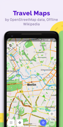
OsmAnd+ (OSM Automated Navigation Directions) is a map and navigation application with access to the free, worldwide, and high-quality OpenStreetMap (OSM) data. Enjoy voice and optical navigation, viewing POIs (points of interest), creating and managing GPX tracks, using contour lines visualization and altitude info, a choice between driving, cycling, pedestrian modes, OSM editing and much more.
Key Features of OsmAnd+
Navigation
Works online (fast) or offline (no roaming charges when you are abroad)
Turn-by-turn voice guidance (recorded and synthesized voices)
Optional lane guidance, street name display, and estimated time of arrival
Supports intermediate points on your itinerary
Automatic re-routing whenever you deviate from the route
Search for places by address, by type (e.g.: restaurant, hotel, gas station, museum), or by geographical coordinates
Map viewing
Display your position and orientation
Optionally align the picture according to compass or your direction of motion
Save your most important places as Favorites
Display POIs (point of interests) around you
Display specialized online tiles, satellite view (from Bing), different overlays like touring/navigation GPX tracks and additional layers with customizable transparency
Optionally display place names in English, local, or phonetic spelling
Use OSM and Wikipedia data
High-quality information from the best collaborative projects of the world
OSM data available per country or region
Wikipedia POIs, great for sightseeing
Unlimited free downloads, directly from the app
Compact offline vector maps updated at least once a month
Safety features
Optional automated day/night view switching
Optional speed limit display, with reminder if you exceed it
Optional speed-dependent zooming
Share your location so that your friends can find you
Bicycle and pedestrian features
Viewing foot, hiking, and bike paths, great for outdoor activities
Special routing and display modes for bike and pedestrian
Optional public transport stops (bus, tram, train) including line names
Optional trip recording to local GPX file or online service
Optional speed and altitude display
Display of contour lines and hill-shading (via additional plugin)
Directly contribute to OSM
Report data bugs
Upload GPX tracks to OSM directly from the app
Add POIs and directly upload them to OSM (or later if offline)
Optional trip recording also in background mode (while device is in sleep mode)
VirusTotal:
Apk:
https://www.virustotal.com/gui/file/56e31882878aa94745d57697f7dfc5c69d2da74e512ec08a2876f3c25bf6eaab/detection
OsmAnd+ Screenshots


